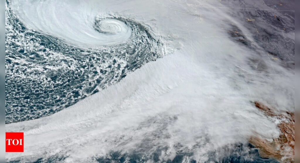
Bomb cyclone hits northwest US, causing major disruptions; power outages affect thousands

A powerful storm system hit the northwest US on Tuesday evening, causing widespread power outages and tree damage across the region.
The weather prediction centre announced risks of excessive rainfall from Tuesday through Friday, as the region faces its strongest atmospheric river of the season. The system has been classified as a “bomb cyclone” due to its rapid intensification.
According to Richard Bann, a national weather service meteorologist, the most severe rainfall is expected between Portland, Oregon, and the northern San Francisco area. He cautioned about flash flooding risks at lower elevations and winter storms at higher altitudes, emphasising the storm’s significant impact.
Near Seattle and along the Oregon coast, hurricane-force winds exceeding 75 mph (121 kph) were anticipated. Larry O’Neill, Oregon climate service director, warned about a “mountain wave” near Seattle that could trigger widespread power disruptions.
By Tuesday evening, approximately 94,000 customers in western Washington and 12,000 in Oregon experienced power outages. The National Weather Service recorded peak wind speeds of 68 mph (109 kph) at Crystal Mountain and 53 mph (82 kph) at Ediz Hook.
Northern California faced flood and high wind watches, with predictions of up to 8 inches (20 centimetres) of rain in various regions. The Sierra Nevada mountains were under a winter storm watch above 3,500 feet (1,066 metres).
In Yolo County, California, crews worked to prevent flooding by clearing drainage systems. Resident Mesena Pimentel recalled February’s floods, telling KCRA-TV, “We had about ten inches of water in our garage, had a couple gophers swimming around.”
Southwestern Oregon anticipated 4 to 7 inches (10 to 18 centimetres) of rainfall through Friday morning, with some areas possibly receiving up to 10 inches (25 centimetres).
The Oregon coast received high wind warnings starting at 4 pm Tuesday, with expected gusts up to 70 mph (113 kph) on beaches. Washington state faced less severe rainfall but significant wind threats, particularly in Pacific County.
The Cascades in Washington, including Mount Rainier National Park, received blizzard warnings with predictions of heavy snow and strong winds. Washington State Ferries reported service disruptions, and transport officials advised postponing travel until Wednesday.
The Washington state department of transportation said, “It will only be a winter wonderland in the sense that you’ll be wondering where the heck you are on any given patch of land.”


